There are many who consider the best method of exploring this area to be on foot. And, indeed, the region is filled with opportunities for hiking. These range from brief interpreted nature walks to full-scale backpacking expeditions in the solitary backcountry. On many area trails, routes are marked with stacked stone mini-monuments known as cairns. Please do not ever dismantle these. In some areas, they are the only route indicators.
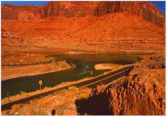
West of Monticello, there are three scenic drives on paved, graded gravel and dirt roads. The Blue Mountain Loop Spring Creek Ranch Road travels over the crest of pine forest, past trout lakes, overlooks canyon rims, then joins U.S. 191 again 5 miles north of Monticello. The Monticello to Blanding Alpine Route leaves the first drive and turns south through the Abajos, travels high mountain roads, and ends in Blanding 32 miles from Monticello. The Blue Mountain Loop Hart’s Draw Road travels from lush Alpine heights on the north side of the mountain into the desert of Canyonlands National Park, offering striking views into the canyons.
The lifelines of the Canyonlands Region are its three rivers – the Colorado River, Green River, and San Juan River. All offer spectacular views of the mighty force of nature at work and exhibit millions of years of geologic history. All three rivers are popular for floating, canoeing, kayaking, and exciting white-water rafting, with tour operators providing services out of Green River, Moab, Monticello, Bluff, and Mexican Hat.
Arches National Park
The world’s largest concentration of natural stone arches is found in Arches National Park. Nearly two thousand of these ‘miracles of nature’, and other unusual formations, grace the 73,000-acre park. One of the more rewarding ways to see the park is on foot. Arches feature short hikes, suitable for all ages, in the ‘Windows’ section of the park, to Double Arch and the North and South Windows (especially lovely at sunset).
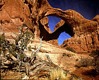
Longer hikes include Delicate Arch (a signature of Utah, and the arch depicted on the state centennial license plate), Tower Arch, Landscape Arch, and Devil’s Garden area trails. Ranger-guided hikes in the Fiery Furnace are a true family adventure; reservations for these hikes must be made in the visitor’s center and the cost is $6 per person. If you plan to enter the Fiery Furnace on your own, a permit is required, and available for $2 per person at the visitor center.
Hiking Arches National Park
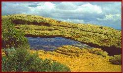 In Arches National Park the path to Delicate Arch is three miles round trip, partially over wavy Slickrock marked by stone cairns. The arch itself is revealed suddenly and dramatically near the hike’s end.
- The Portal Overlook Trail takes off from Potash Scenic Byway 279 and climbs over a mile and a half to the Portal Overlook with views of the Colorado River, the La Sal Mountains, and the Moab Valley. The Corona Arch Trail also begins at a trailhead adjacent to the Potash Scenic Byway 279. It is a pretty 1.5-mile hike across the Slickrock at the base of Corona and Bowtie arches.
- Negro Bill Canyon has a cool, year-round stream. Two miles from the trailhead on Colorado River Scenic Byway 128 is Morning Glory Bridge, a large natural stone span carved by ages of rushing water.
- The 3 mile Moab Rim Trail is also popular with hikers for its vistas of the Colorado River, Moab, and the formations of the Behind The Rocks Wilderness Study Area. The connecting Hidden Valley Trail accesses a sheltered valley and provides more views of Behind the Rocks.
- A cool canyon bottom hike is found in Hunters Canyon accessed off Kane Creek Canyon Road. In spring months, the 4-mile round trip yields a pool filled stream shaded by shaggy cottonwoods
- The trail at Butler Wash Indian ruins winds its way across several washes and over the slick rock before reaching an overlook of a small cliff dwelling. Round trip hiking distance is one mile and the trail is rated “moderate” difficulty.
- Lloyd’s Lake located near Monticello offers a leisurely 2.5-mile trail around the lake.
- There are many hiking trails on the Abajo Mountains including Red Ledges, Aspen Flat, and Spring Creek. All of this access still more trails on the north side of the mountain near Monticello.
- The Pipeline trail passes through juniper, ponderosa, and aspen with striking views of desert canyons and verdant mountains. The 3 1/2 mile trail remains at 8,000 ft. throughout.
- Skyline Trail is aptly named. It begins at the trailhead on the causeway 8,000 ft. in elevation and climbs upward to and above the treeline. Views open in all directions.
A 52-site campground is located in the park and campfire programs are conducted nightly during the summer. Entrance and campground fees are collected.
Arches National Park is open year-round. The daily entrance fee is $10 per car. Annual individual passes are $25. Golden Eagle Passports are $50 and good for one full year. (Fees are subject to change.) Arches’ peak visitor season runs from mid-March through October and The cooler weather months, when snow occasionally blankets the red rocks, is a particularly pretty time to visit.
Blanding, Utah
Centrally Located near Natural Bridges and Hovenweep National Monuments, Glen Canyon National Recreation Area/Lake Powell, and the Abajo Mountains. Blanding serves as a base camp to adventure, including hiking, biking, backpacking, boating, 4-wheeling, and sightseeing. Two world-class museums are located in Blanding: Edge of the Cedars State Park Museum features the largest collection of Puebloan artifacts in the Four Corners region and The Dinosaur Museum includes authentic life-size models. Blanding is the gateway to the Trail of the Ancients, an autoroute following a loop through southeast Utah. All services are available. For more information: www.blandingutah.org
Bluff, Utah
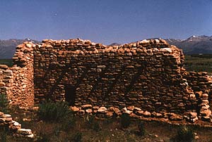
The oldest pioneer community in southeastern Utah, Bluff is a living museum of archaeology, geology, pioneer history, and contemporary art. It is a starting point for trips on the San Juan River. The pioneer cemetery is located on a hill overlooking the town and many of the original sandstone homes still survive. Bluff was a center of prehistoric life and rock art and ruins are nearby. An informative brochure about both the community and the surrounding area is available at many of the businesses. All services are available. for more information: www.bluff-utah.org
Canyonlands National Park
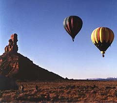
Canyonlands National Park is divided neatly into three sections by the Green And Colorado Rivers. These sections, named Island in the Sky, the Needles and the Maze for their most prominent geologic characteristics, are quite different in what they offer and their access. Canyonlands is the largest national park in the state, and its diversity staggers the imagination. Thousand-foot views down into river canyons, or up, to red rock pinnacles, cliffs and spires are truly awe-inspiring. Visitors may explore the park by driving a passenger car on paved roads to the Needles and Island in the Sky Districts, or by traveling the network of four-wheel-drive roads found throughout the park.
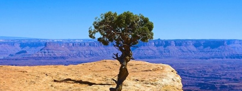
Canyonlands National Park is open year-round. Visitor centers are located in each of the three districts, and they are open year-round, except in the Maze, where Hans Flat Ranger Station closes during the winter months. Ranger talks and programs are offered from March through October.
Primitive camping is available in all three districts. The 26-site Squaw Flat Campground in the Needles District has water and a nightly fee. The 12-site Willow Flat Campground at Island in the Sky has no water and no fee. Additional primitive sites are located along many four-wheel-drive roads in the park. Backcountry permits are required for these sites.
A fee is charged for the use of backcountry vehicle campsites. A backcountry permit for backpackers is also required. All backcountry campsites, including those in the Needles District and along the popular 100-mile White Rim Road in the Island in the Sky District, require an advance reservation available through the park’s advance reservation system, (435) 259-4351. For more information about the park contact Superintendent, Canyonlands National Park, 2282 Southwest Resource Blvd., Moab, UT 84532, (435) 719-2313 or on their website
Canyon Rims Recreations Area
Canyon Rims Recreations Area is vast and diverse, offering scenic overlooks, camping, OHV trails, hiking/backpacking, and bicycling. Special areas within its boundaries provide a special experience. The Dark Canyon Primitive Area and the Indian Creek, Bridger Jack Mesa, Middle Point, and Butler Wash Wilderness Study Areas all are distinct.
Access is from US 191 via paved, graveled, or graded dirt roads. Primitive OHV trails are accessible but vary widely in condition and difficulty. Developed hiking trails are found throughout the area. Most of the Canyon Rims are primitive and undeveloped. Two campgrounds, Wind Whistle, with seventeen sites, and Hatch Point, with nine sites, are easily accessible. There are no hook-ups or flush toilets. A fee is charged from April through October when drinking water is provided. Two primitive camping areas are found at the southern end of the Lockhart Basin OHV trail near Indian Creek. Picnic tables and pit toilets are provided. Two impressive viewpoints, Needles and Anticline Overlook, are also easily accessible and offer outstanding views of the canyon floor 1000 feet below. For more information: www.ut.blm.gov/monticello
Dead Horse Point State park
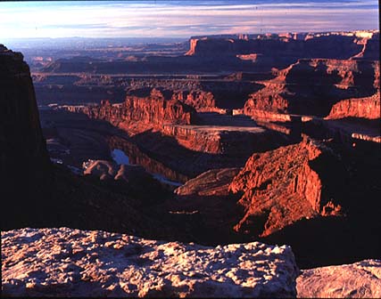
Perhaps Utah’s most spectacular state park, Dead Horse Point towers 2,000 feet above the Colorado River – providing a breath-taking panorama of Canyonlands sculptured pinnacles and buttes. Access is via a 23-mile drive ‘up’ U-313, which begins north of Moab. This state park has a visitor center with interpretive exhibits, modern restrooms, a 21-unit campground, and a large overlook shelter. For more information, write Dead Horse Point State Park, P.O. Box 609, Moab, Utah 84532-0609, or call (435) 259-2614, (800) 322-3770.
Edge of the Cedars State Park
Edge of the Cedars State Park is the site of ancient Puebloan ruins and a museum facility housing the largest display of Puebloan artifacts in the Four Corners Region of the United States. the ruin is included in the National and Utah State Registers of Historic Places. Edge of the Cedars ruin was a small Chacoan village occupied from A.D. 825 through 1220. The museum houses historical displays of the various cultures that have influenced life in southeastern Utah and operates a Discovery Room with hands-on artifacts, where you can grind corn with a mano and metate, or try your hand at weaving a Navajo rug. Symbolic rock art is reproduced throughout the museum and grounds. The museum offers a variety of public programs and changing exhibits with themes such as rock art, archaeoastronomy, Native American arts, and recent research in archaeology. Located at 660 West on 400 North in Blanding, the park is open daily. (435) 678-2238 www.nr.state.ut.us/parks
Goosenecks State Park
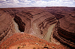
Gooseneck State Park, located on a plateau overlooking the Great Goosenecks of the San Juan River, provides a view of the river’s twists and turns 1,000 feet below in one of the most striking examples of an entrenched meander in North America. Over 300 million years of geologic history is exposed. Environments ranging from wind-blown deserts to stream covered plateaus, ancient seas, and volcanic intrusions are encompassed in the formations you see. The canyon you view from Goosenecks State Park is the result of erosion, which also exposed Alhambra Rock, seen on the horizon to the south and Shiprock in New Mexico to the east, are solidified molten rock forced up through overlying layers twenty to thirty million years ago, and exposed by erosion of the surrounding layers. Erosion also revealed the folds in the earth’s crust at Raplee Anticline, forming the skyline to the east, which is an example. Activities at the park include picnicking, sightseeing, and hiking, Please use caution, there are many loose rocks and high ledges. Located nine miles northwest of Mexican Hat, the park is accessible off Utah Highway 163. Open year-round, restroom facilities, no water.
Grand Gulch Primitive Area
Off U-276, Grand Gulch Primitive Area has been set aside by the Bureau of Land Management (BLM) for non-vehicle use. This wilderness canyon protects some fine examples of Pueblo ruins and rock art panels. Access is by foot or horseback only. Register first with the BLM in Monticello or at the ranger station near Grand Gulch.
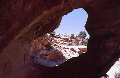
Hovenweep National Monument
Hovenweep, a Ute word meaning “deserted valley,” consists of six archaeological sites representing the climax of ancient Pueblo village life 700 years ago. At the time the Europeans were building castles of rock, the Pueblo people were building towers and villages of rock. These villages were a part of larger ancestral pueblo society present in the Four Corners region of Colorado, Utah, Arizona, and New Mexico until A.D. 1300. Their descendants now live in communities in Arizona and New Mexico.
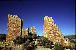
The campground at Hovenweep is open year-round with 31 sites. Vehicles over 25ft are not recommended. Running water and flush toilets are available during winter months.
Access to Hovenweep is via Utah State Hwy. 262. There is a short section of gravel before entering the National Monument. Follow the signs to the clusters of ancient Pueblo multi-storied towers, houses, kivas, storage shelters, and check dams. Two short loop trails originate at the Ranger station. Other trails lead to the outlying ruins.
For more information contact Hovenweep National Monument at (970) 749-0510 or cal San Juan County Visitor Information at 800-574-4386. www.nps.gov/hove
Lake Powell
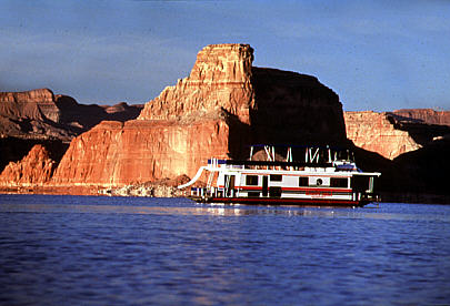
More than one million acres of stunning desert land is to be found in Glen Canyon National Recreation Area. Lake Powell is the center of this vast beauty. The twisting, sinuous canyons offer mystery and rugged terrain combined with opportunities for camping, boating, fishing, and other water sports. lake Powell stretches 186 miles with 1800 miles of shoreline. Boats can be rented at any of the five marinas for exploring the vast stretches and hidden canyons of the lake where ancient ruins and rock art, natural arches and hidden alcoves can be found. Accommodations and campgrounds are available at Halls Crossing and Bullfrog Marinas. The 100-foot ferry, John Atlantic Burr, crosses the lake daily on a regular schedule between Halls Crossing and Bullfrog Marinas. The ferry accommodates passengers, vehicles, and trailers of all sizes. Visitor information is available at Hite, Halls Crossing, and Bullfrog Marinas. Limited supplies are available at the Marinas. For lodging, tours, and recreational rentals contact ARAMARK at 800-528-6154 or www.visitlakepowell.com. Park information is available at 520-608-6404 or www.nps.gov/glca.
Mexican Hat
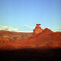
Named for the rock formation that resembles an inverted sombrero visible on the east side of the highway north of Mexican Hat, this small community is popular with river runners. The area is brimming with day trips to Natural Bridges National Monument, Grand Gulch Primitive Area, Goosenecks State Park, Valley of the Gods, and Monument Valley Navajo Tribal Park. All services are available. For more information: www.southeastutah.com
Moab, Utah
Often referred to as “the Heart of the Canyonlands,” Moab offers every service required by the traveler. River and land tour operators are based here and complete accommodations are available. Moab is the only city in the State of Utah located on the Colorado River and enjoys a mild climate because of its low elevation (4,000 ft.). The majestic La Sal Mountains rise to an impressive 13,000 feet within a 35-mile distance, enhancing the setting…a beautiful contrast between colorful red rocks and cool, lofty peaks. For more information, you can call the Moab Area Travel Council at 435-259-1370 or www.discovermoab.com
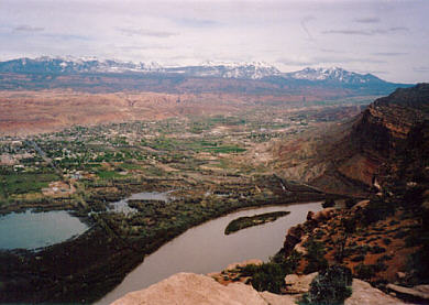
Monticello, Utah
Nestled at the foot of the Abajo or Blue Mountains, Monticello’s 7,000-foot elevation affords an unmatched array of vistas and panoramas. the Abajo Mountains rise directly to the west and offer hiking, four-wheeling, camping, bicycling, and winter sports. The entrance to the Needles District of Canyonlands National Park is northwest of Monticello. Mesa Verde National Park and Monument Valley Navajo Tribal Park are within easy driving distance. All services are available at this gateway to central Canyonlands. For more information: www.southeastutah.com
Monument Valley Tribal Park
On Scenic Byway US-163 at the Utah/Arizona line, world-famous Monument Valley is and has been used for scores of movies and commercials. The road into Monument Valley is paved to the visitor center, museum, and campground. The remainder of the roads is maintained dirt, although caution is advised during inclement weather.
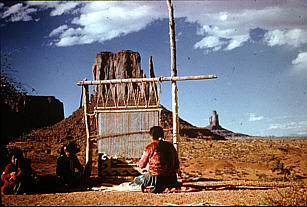
There is a self-guiding loop, but for exploration further into the park, a guided tour is required. Guided tours are available from park headquarters, Monument Valley, Bluff and Mexican Hat. This mile-high monument-studded paradise is all on the Navajo Reservation. Although the Navajo culture is changing, the “monuments” themselves remain virtually as they were thousands of years ago.
Muley Point
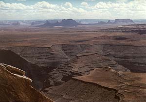
Located in the Glen Canyon National Recreation Area and five miles off Utah Highway 261, this spectacular overlook offers a vast panorama of canyon country, with Monument Valley in the distance. Utah 261, leading to Muley Point, travels over the Moki Dugway, a graveled three-mile series of tight switchbacks ascending 1000 feet to the top of Cedar Mesa. The road to Muley Point itself is native surface, and if muddy should not be traveled. Muley Point, while offering spectacular views to the valley below is not developed and there are no restraints, visitor information, or staff available. Care should be exercised.
Natural Bridges National Monument
Off Bicentennial Scenic Byway U-95, this monument offers a unique view of the largest display of natural bridges in the world. intermittent streams have cut two deep canyons and three massive bridges from the white sandstone that once formed the shore of an ancient sea. Trails descend to each of the three bridges. Sipapu Bridge is the second-largest natural bridge in the world. In Hopi mythology, the “sipapu” is the gateway to the spirit world. The trail to its base is the steepest in the park. A staircase and three ladders aid in the descent. Kachina Bridge is the youngest of the bridges and the most massive of the three. The trail down to the bridge passes the “Knickpoint” pour-off in Armstrong Canyon below. During flash floods, a muddy red waterfall rushes over this point to fall into the pool below. Owachomo, or “rock-mound” in the Hopi language, is named for the rock formation at the side of the bridge. The creek which carved the bridge has changed course and no longer flows beneath Owachomo. This bridge is the oldest of the three and the most delicate. the eight and one-half mile loop trail connecting the bridges may be started at any parking area, but starting at Sipapu is recommended.

A large photovoltaic solar array, which provides 90% of the park’s power can be viewed near the Visitor Center. The campground is open year-round with thirteen sites. There are no hook-ups and the maximum length is twenty-one feet. Fee area. For more information www.nps.gov/nabr
Newspaper Rock Recreation Site
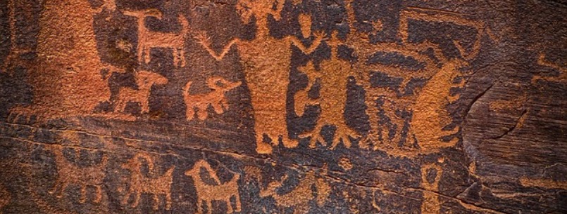
Located along Utah Highway 211, the Newspaper Rock Recreation Site displays rock art from multiple periods between 1500 years ago to the beginning of this century. The older art is attributed to the ancient Puebloan people who lived here from 100 BC to 1540 AD. The more recent art, which is lighter in color, is attributed to the Ute people who still live in the Four Corners area. The area offers a primitive campground, grills, picnic tables, and a nature trail. There is no fee, and no water available. For more information: www.ut.blm.gov/monticello
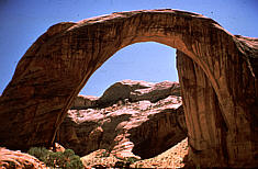
Rainbow Bridge National Monument
One of the seven natural wonders of the world, the Rainbow Bridge National Monument rises 309 feet above the streambed below and is large enough to span the Statue of Liberty or the U.S. Capitol. It can be reached by boat tours via Lake Powell or by trail from Navajo Mountain Trading Post (14 miles). Navajo Nation permit required, from Navajo Mountain
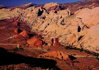
San Rafael Swell
The San Rafael Swell is a 900-square mile, wild and beautiful region west of the Green River. The Swell is dominated by the jagged, uplifted San Rafael Reef, which has nearly two dozen major canyons and many side-draws and box canyons. The Reef’s crests rise between 800 and 1500 feet above the nearby desert flats. Two rivers meander and slice through the Reef on their way to the Green River. The Swell is filled with the history of cowboys, outlaws and ancient Indians and rockhounding areas abound. Three Grand County Travel Council brochures: A guide to I-70, Recreation Guide to the San Rafael Area and San Rafael Desert Loop Auto “Tour, provide more detailed information on this area.
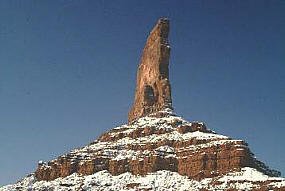
Valley of the Gods
Off U.S. 163, this loop drive offers views of unique rock formations jutting hundreds of feet into the air. The “inhabitants” of the valley are imaginary animals, stately gods, or whatever the imagination inspires. Native surface, check locally for conditions.
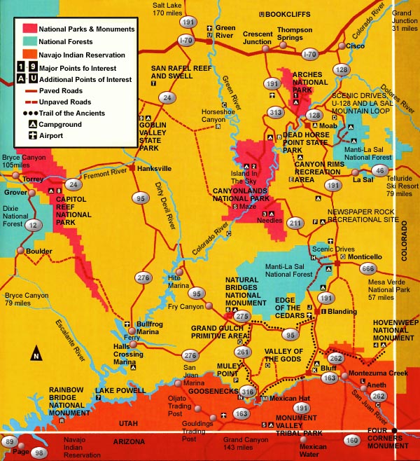
Canyonlands Area Map
Four-Wheel Drive Trails
The Chicken Corners Trail is almost 22 miles one-way following the Colorado River and Kane Creek Canyon, then climbing to Hurrah Pass and descending to the benches carved by the Colorado River long ago. The trail ends high above the river and roughly across from Dead Horse Point State Park.
The Gemini Bridges Trail covers about 14 miles between US-191 and U-313. It is an access road to several other trails, and it is spectacular in its own right because of the sweeping views and the obligatory side trip to the twin bridges that are its namesake.
Monitor and Merrimac Buttes, named for Civil War vessels, rise dramatically out of the desert along the highway leading to Canyonlands’ Island in the Sky District. The Monitor and Merrimac Trail reaches the buttes via a looping 15-mile route through lavishly-colored canyons and stretches of mesa punctuated by cliffs and towers.
The popular Poison Spider Mesa trail cuts across a mesa north of the Colorado River, west of Moab, The trail is dominated by rolling slick rock terrain. Perhaps the most spectacular views on the moderate 16-mile trek are the unobstructed vistas of the distant La Sal Mountains and Behind the Rocks Wilderness Study Area.
The Moab Rim Trail is a 7-mile vehicle trail rated as difficult. It affords views of Moab, the Colorado River, Spanish Valley, and the La Sal Mountains. Consult the Grand County Travel Councils four-wheel-drive brochure for more information on these trails.
There are four-wheel-drive roads in both Arches and Canyonlands National Parks. The best known are bumpy Elephant Hill in Canyonlands Needles District and the spectacular White Rim Trail in Island in the Sky District with its views of majestic Monument Basin. The Maze District, true to its name, offers seemingly limitless explorations. Backcountry restrictions apply in both parks. Inquire at the park visitor’s centers for detailed trip information.
Hole In The Rock Trail is accessed from U95 near Natural Bridges N.M. Drive-thru sand, broken rock, and sandstone. The trail is challenging with steep ascents/descents and severe off-camber spots. It is remote & unforgiving and culminates at an overlook of Lake Powell. Arch Canyon is in the heart of canyon country and takes you through washes, over sandstone, and into narrow canyons. View petroglyphs & ruins in a remote canyon setting.